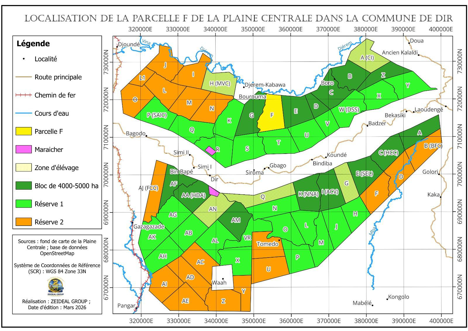
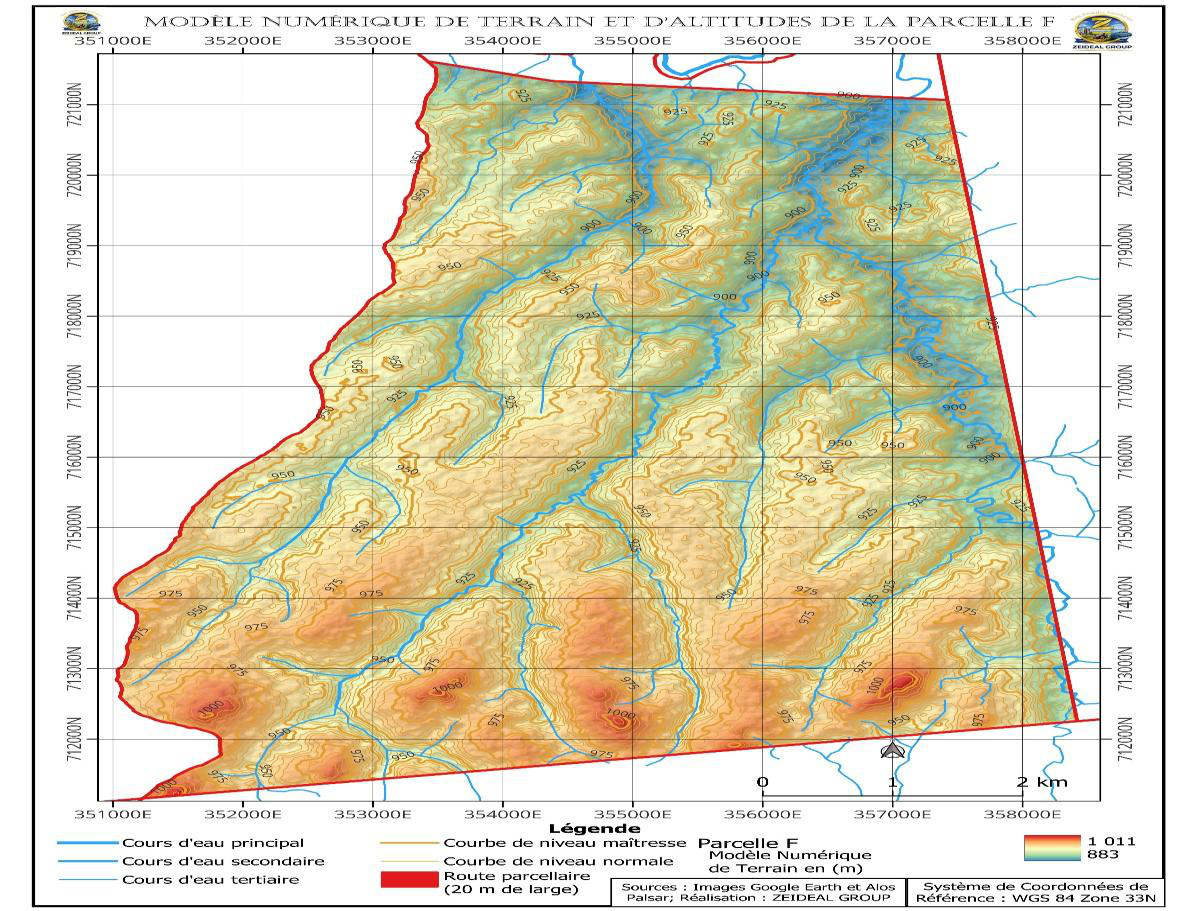
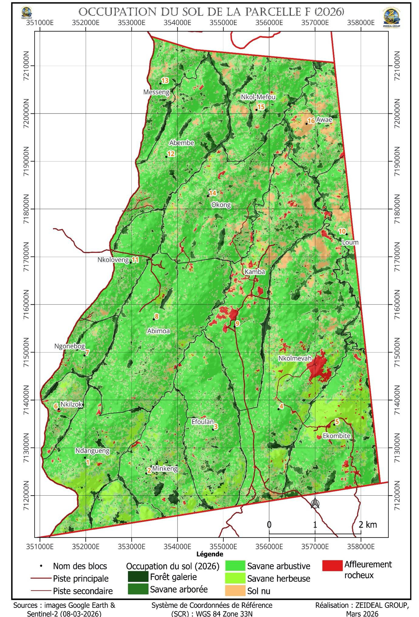
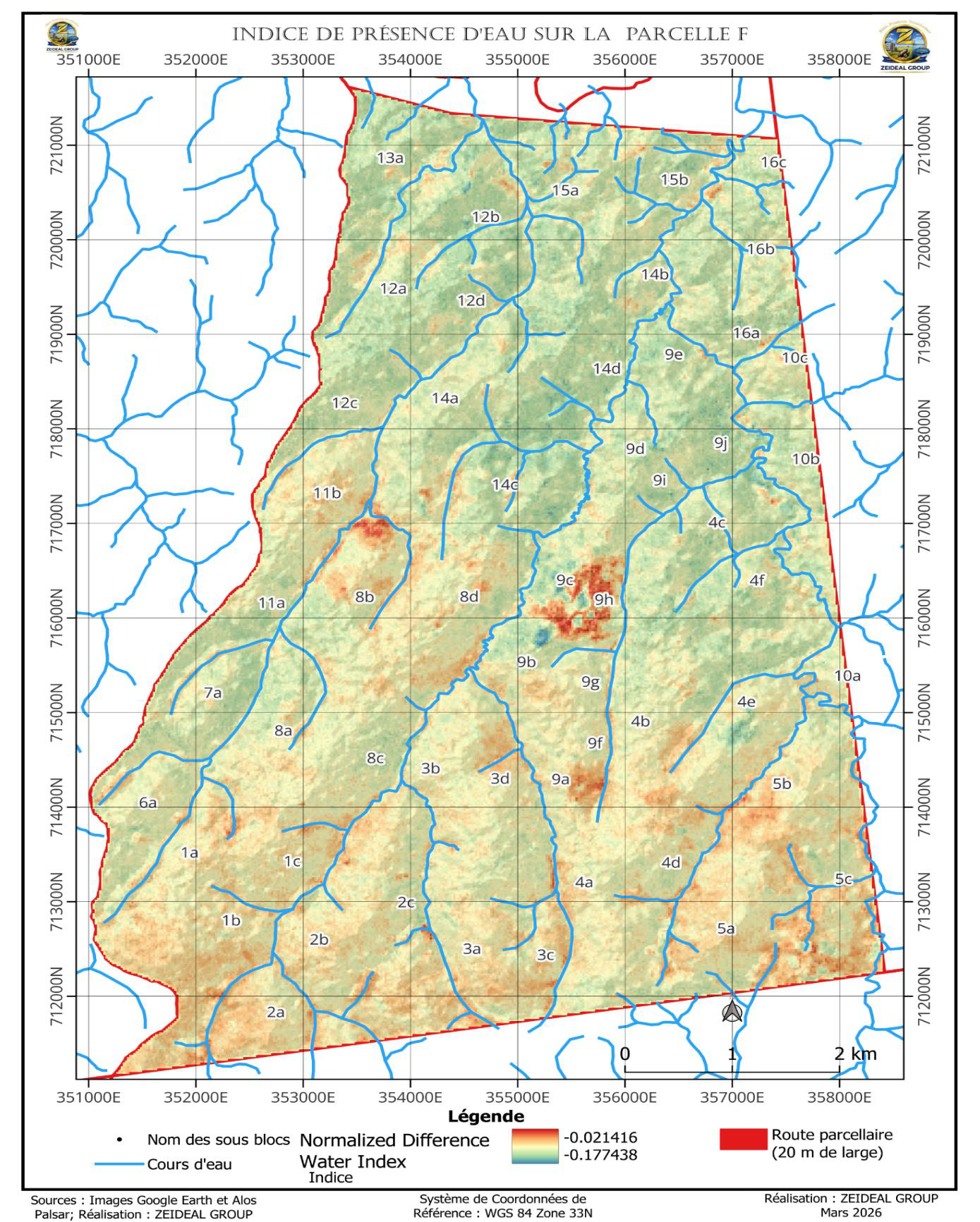
DIR Agro-Industrial Hub

Agro-industrial hub · Adamaoua

DIR Hub — The agro-industrial foundation of PROAQUI

5,380 hectares granted by the Republic of Cameroon under the "Plaine Centrale" programme · Irrigated industrial farming · Bühler do Brasil feed plant, 100,000 tpa (76 kt fish + 24 kt related).

Home · The Project · DIR Hub

Location and land status

Secured, immediately operational land


The DIR Hub is located in the Dir municipality, Djérem department, Adamaoua Region, Republic of Cameroon. The plot granted by the Cameroonian State covers 5,380 hectares, dedicated to irrigated industrial agricultural production under center-pivot irrigation. The balance is allocated to industrial infrastructure, residential bases, environmental buffer zones (ecological corridors, grass strips) and land reserves for future extensions.

RegionAdamaoua, Republic of Cameroon
DepartmentDjérem
MunicipalityDir
Total land area5,380 hectares
Institutional frameworkState "Plaine Centrale" programme — Dir commune, Djérem (Adamaoua)
Land statusLand granted by the Cameroonian State (land title)
Overview of the DIR Pole — 5,380 hectares agro-industrial complex

Site characterization — Phase 0

A concession characterized to international standard


Ahead of any industrial commitment, the Dir concession underwent a full topographic, pedological, hydric and climatic characterization, carried out by ICERD Cameroon on the basis of ALOS PALSAR satellite imagery (12.5 m), the WGS 1984 UTM33N geodesic reference and MINADER-sourced data. This field knowledge base drives the agronomic choices, the soil amendment plan and the management of the water resource.

Topographic characterization map of the Dir concession: 5,380.51-hectare main parcel, 218.56-hectare buffer zone along the Djérem river, soil and water sampling points, altitude bands from 883 to 1,011 metres

Topography and land layout

The topographic survey confirms a main parcel of 5,380.51 hectares, bordered to the north by the Djérem river, on moderate relief ranging from 883 to 1,011 metres in altitude. A 218.56-hectare environmental buffer zone runs along the Djérem, providing an ecological corridor and bank protection. The parcel is subdivided into operating sub-blocks supporting 43 georeferenced soil sampling points and 14 water sampling points.

Main parcel area5,380.51 ha
Buffer zone (Djérem corridor)218.56 ha
Altitude883 – 1,011 m
Sampling points43 soil · 14 water (georeferenced)
Geodesic referenceWGS 1984 UTM33N · ALOS PALSAR 12.5 m

Agricultural land layout — Block F of Dir I

The concession forms Block F of Dir I within the "AGRO PARC" programme of the Plaine Centrale (Batchenga–Ntui–Yoko–Tibati–Dir–Ngaoundéré corridor). The agricultural surveying study generated the digital surface and terrain models (DSM/DTM) and divided the block into 16 operating sub-blocks, totalling 5,406.8 hectares, named after the neighbouring localities.

Land survey document

Full characterisation & parcelling report

The hydric characterisation and parcelling study of Block F (Volume 4, April 2026) is available online and for download: 2026 land cover, hydrology, climate and geo-referenced subdivision into 16 sub-blocks and 54 parcels.

Read the study 📄 Download report (PDF)

Climate — 31 years of data (1994–2025)

Climate analysis over three decades (NASA POWER source) confirms a favorable highland tropical climate for rain-fed and irrigated agricultural intensification, with a marked rainy season from May to October. Annual rainfall of 1,578.8 mm and a mean temperature of 23.4 °C define the cropping window from 1 May to 30 September.

Mean annual rainfall1,578.8 mm (August peak 282 mm)
Mean temperature23.4 °C (15.7 to 31.1 °C)
Mean relative humidity71%
Potential evapotranspiration5.51 mm/day
Mean sunshine12 h/day

Soils — a characterized agronomic potential

The concession's soils are predominantly clayey (48 to 57% clay), acidic (pH 3.6 to 6.0) and rich in organic matter (3.9 to 5.1%, C/N ratio close to 18). They show a cation exchange capacity of 12 to 14 meq/100 g, but limited phosphorus availability and base saturation. Parametric evaluation (Khiddir method) ranks the lower zones (880–900 m) as suitable to moderately suitable for maize and soy. This diagnosis underpins a targeted amendment plan — liming and phosphate fertilization — built into the technical itinerary, complemented by organic fertilization from the aquaculture loop (recovered effluents).

Water resource — confirmed quality

The concession's surface waters are weakly mineralized freshwater (conductivity 19 to 27 µS/cm) of acceptable, low-risk bacteriological quality: complete absence of Salmonella, Shigella, Vibrio and Staphylococcus, with controlled coliform loads. Organic-load indicators (COD 7 to 12 mg/L, BOD₅ 4 to 5 mg/L) remain low. This resource secures the water needs of irrigated agriculture and of the pole's infrastructure.

Phase 0 · Characterisation study

Block F hydric characterisation and parcelling study


Conducted in April 2026 (Volume 4), the Block F characterisation study documents the location and relief, land cover, hydric regime and parcel layout of the concession, based on satellite imagery (ALOS PALSAR, Sentinel-2) and georeferenced field surveys. The chapters and figures below present its main findings.

Chapter 1 — Location

Location and relief of Block F


Block F (Parcel F, in yellow) lies within the Central Plain, in the Bagodo agricultural post (Dir commune, Djérem department). It is bounded to the north by the Djérem river and accessed from National Road N°6 near the village of Sourma, on a plateau relief ranging from 883 to 1,011 m in elevation.

Location map of Parcel F within the Central Plain of Dir commune
Figure 4 — Location of Parcel F within the Central Plain (WGS 84 — UTM Zone 33N).
Digital terrain model and oro-hydrography of Parcel F
Figure 5 — Digital terrain model and oro-hydrographic network of Parcel F.

Chapter 2 — Characterisation

Land cover — 2026


Land-cover mapping relies on Sentinel-2 remote sensing (8 March 2026) and a supervised maximum-likelihood classification (ENVI 4.5 software), with an overall accuracy of 92.85% and a Kappa index of 0.88. Shrub savannah largely dominates, and nearly 93% of the area is suitable for agriculture.

Land-cover classArea (ha)Share (%)
Shrub savannah3,734.0969.42
Tree savannah465.688.66
Grass savannah445.748.29
Bare soil357.086.64
Gallery forest228.084.24
Rocky outcrop148.192.76
Total5,378.86100.00

Protected areas

Gallery forests, watercourses and rocky outcrops (≈ 7%) are preserved for biodiversity conservation and as natural windbreaks. Rocky outcrops (3%) may host the living base, machinery hubs and maintenance workshops.

Land-cover map of Parcel F in 2026 from Sentinel-2 classification
Figure 11 — Land-cover classes of Parcel F in 2026 (supervised Sentinel-2 classification).

Hydric characterisation

Water, climate and hydrological regime


Block F is drained by numerous watercourses, tributaries of the Djérem river to the north, and crossed by three main south-to-north watercourses. The plot lies about 700 m from the Djérem (up to 50 m wide in places) and contains many wetlands. The water-presence index (NDWI) computed in March is negative, reflecting the absence of extensive surface water in the dry season — hence the importance of an irrigation strategy drawing on the Djérem.

ClimateTropical Sudano-Guinean, two seasons
Rainy seasonMay to October (peak July–August)
Annual rainfall1,300 – 1,700 mm
Mean temperature≈ 24 °C
Hydrological regimeTransitional tropical pluvial (specific module < 10 l/s/km²)
Geodetic referenceWGS 84 — UTM Zone 33N · ALOS PALSAR
Hydrographic network map of Parcel F
Figure 12 — Hydrographic network of Parcel F (three main south-to-north watercourses, tributaries of the Djérem).
Water-presence index (NDWI) map of Parcel F
Figure 13 — Water-presence index (NDWI) on Block F: negative values in the dry season (March).
Wetland within Parcel F
Wetland along the watercourses (geo-referenced field survey, March 2026).
The Djérem river in its minor bed
The Djérem in its minor bed, 700 m north of Parcel F (geo-referenced field survey).

Chapter 3 — Parcelling

Subdivision into 16 sub-blocks


The subdivision accounts for soil type, relief (contour lines), the hydrographic network and existing tracks, in line with the layout proposed by MINADER (at least 100 ha per parcel). Block F is divided into 16 sub-blocks and 54 parcels, totalling 5,406.8 hectares, named after the neighbouring localities.

Sub-blockArea (ha)Elevation (m)Subdivision
Nkolmevah793.6891 – 1,0026 parcels
Abimoa575.8908 – 9834 parcels
Kamba521.7889 – 96610 parcels
Okong447.3890 – 9664 parcels
Ekombité414.1906 – 1,0093 parcels
Minkeng381.8916 – 1,0043 parcels
Efoulan376.5913 – 1,0064 parcels
Abembé363.9885 – 9584 parcels
Ndangueng318.1925 – 1,0113 parcels
Nkol-Mefou299.6884 – 9572 parcels
Awae211.3883 – 9473 parcels
Nkoloveng168.9906 – 9582 parcels
Messeng148.2885 – 963Single block
Loum146.3892 – 9423 parcels
Ngonebog116.0925 – 976Single block
Nkilzok96.0928 – 981Single block
Total Block F5,406.8883 – 1,01154 parcels

The report's geodetic annex details the boundary coordinates (WGS 84 — UTM Zone 33N) of each of the 16 sub-blocks.

Map of the 16 sub-blocks of Parcel F and their areas
Figure 15 — The 16 sub-blocks of Block F and their areas.
Map of all parcels across the sub-blocks of Parcel F
Figure 31 — All 54 parcels across the sub-blocks of Block F.

DIR's four activities

Four activities, and four only


Activity 01

Agricultural hub — Maize and soy

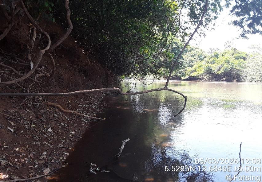
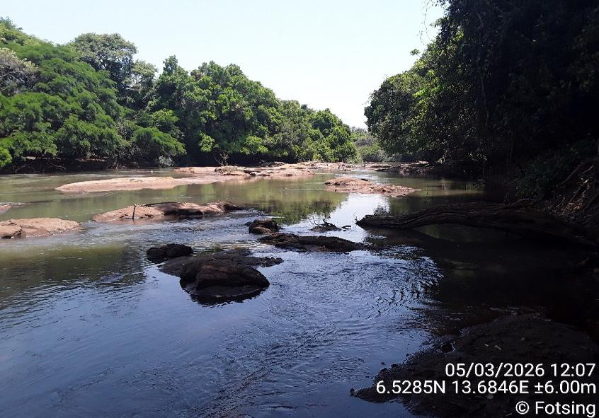
Large-scale irrigated industrial farming on the 5,380-hectare concession, run under the 70/30 model (70% in-house, 30% via Partner Farmers). Crops: maize and soy as priorities, rice bran and oilcake as complements. Heavy mechanization, agronomic intensification and organic fertilization (aquaculture effluents via the return loop).

Activity 02

Bühler do Brasil feed plant

Total industrial capacity of 100,000 tonnes per year (76,000 t fish feed + 24,000 t related feeds: poultry, cattle, pig), Bühler do Brasil extrusion technology. Multi-species plant: fish feed as priority, then poultry, cattle and pig feed in connected lines deployed progressively. Sized beyond internal needs, it generates a surplus sold to third-party farmers.

Activity 03

Agro-industrial residential base

Employee housing, collective catering, social and sports facilities. Accommodation capacity sized for permanent DIR Hub teams. Logistical coordination with the Mbakaou and Nyong aquaculture sites.

Activity 04

CEMAC distribution platform

Logistics center for distributing frozen products to Cameroon and the broader CEMAC sub-region (Gabon, Chad, Central African Republic, Congo, Equatorial Guinea). Export flow coordination and cold chain.

Process flow of the Bühler do Brasil feed plant — 100,000 t/year capacity
Detailed agricultural zoning plan of DIR Pole with triennial rotation

Strict architectural rule

What DIR is not

DIR hosts NO hatchery, NO floating cages, NO aquaculture processing unit.

These functions are operated exclusively at the Mbakaou and Nyong aquaculture sites, which each have their own site-level hatchery and their own IQF freezing unit. This strict separation guarantees the coherence of the integrated value chain and the operational resilience of the project.

Agronomic characteristics

A favourable agronomic environment


The soil study conducted by the International Centre of Environmental Studies and Research for Development (ICERD) in 2026 confirms the quality of the DIR site's agronomic substrate: good overall fertility, a structure favourable to cultivation, and adequate water-retention capacity (in the presence of silty-clay materials). Monitoring of deep compaction and organic-matter management is built into the technical itinerary.

ParameterValueSource
Water-table depthGreater than 1 mICERD 2026
Parent materialDeposit over gneiss with ferruginous hardpanICERD 2026
TopographyGently undulating — slopes, valleys, plainsICERD 2026
Dominant porosityLow to moderate porosityICERD 2026
Target crop cyclesMaize 8–10 t/ha · Soy 5–6 t/haBusiness Plan

Discover the aquaculture sites

Mbakaou and Nyong